

Ranville; Lower Normandy; France
Frame details
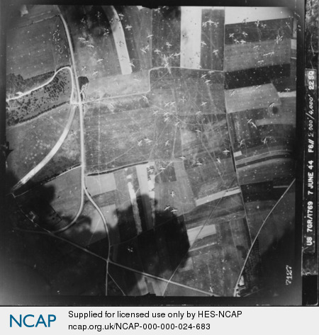
Date: 07 June 1944
Location: Ranville; Lower Normandy; France
Coordinates (lat, lon): 49.237404, -0.253074
Description: British Horsa and Hamilcar gliders on Landing Zone 'N', north of Ranville. Airborne troops were flown here early on D-Day to sieze key bridges and hold the eastern flank of the invasion against German counter-attacks. They also attacked and destroyed the Merville Battery, 3 miles to the north, which was considered to be a threat to the landings on SWORD Beach.
Sortie: US7/1769
Frame: 7127
Corporate bodies: 22nd (Photographic Reconnaissance) Squadron (USAAF)
People: Hawes, Clark, Lt
Frame: 7127
Corporate bodies: 22nd (Photographic Reconnaissance) Squadron (USAAF)
People: Hawes, Clark, Lt
Image type: Vertical
Scale: 6000
Scale: 6000