

Vierville-sur-Mer; Lower Normandy; France
Frame details
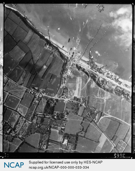
Date: 27 June 1944
Location: Vierville-sur-Mer; Lower Normandy; France
Coordinates (lat, lon): 49.376365, -0.904051
Description: During a storm on 19 June, many of the concrete sections of the Mulberry 'A' artificial harbour broke loose, wrecking the network of floating causeways and jetties. This image shows numerous Landing Ship Tanks (LST) washed up against pontoon 'Whale' roadways and onto the beach. Flat-topped 'Phoenix' prefabricated concrete breakwaters can be seen afloat and onshore. Merchant cargo and tanker ships lie offshore (one with barrage balloon aloft) with an escort corvette-type warship. DUKW amphibious trucks can be seen shuttling supplies and personnel between ships and the beach, while numerous vehicles can be seen heading off the beach along roads and into vehicle parking areas to the south.
Image type: Vertical
Scale: 9000
Scale: 9000