Operation Market Garden was the Allied attempt to sieze key river bridges in The Netherlands by airborne assault in September 1944, to allow the Allies to cross the River Rhine and attack Germany's industrial heartland in the Ruhr. British Field Marshal Bernard Montgomery conceived the plan, and believed its success would end the Second World War by Christmas 1944.
Before an operation of this magnitude could be launched, aerial reconnaissance had to be undertaken to allow photographic interpreters to assess the strength of German defences at the target bridges, select suitable drop and landing zones for paratroops and gliders, study the planned route of the ground troops who were tasked to link-up with the airborne elements, and to identify enemy defences and order of battle in the surrounding area.
On 6 September 1944, photo-reconnaissance Spitfires of 541 Squadron, RAF, were tasked to carry out three low-level sorties over the bridges at Arnhem, Nijmegen and Grave, to collect imagery for use in the planning of Operation Comet, a smaller version of Market Garden employing only one airborne division. Comet was subsequently cancelled on 10 September and replaced by the much larger Market Garden operation.
This feature highlights some of the aerial reconnaissance images taken in the lead-up to the assault, and during the battle for the bridge at Arnhem.
|
Arnhem
Here, the aircraft sent to Arnhem on 6 September banks low over a yacht and pontoon ferry as the pilot begins his run-in to the road bridge from the west.
|
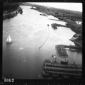 |
| Passengers waiting for a river ferry turn to watch as the aircraft swoops fast and low overhead on its approach to the Arnhem bowstring road bridge. |
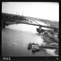 |
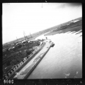
| Banking right, to avoid a pylon on the north bank of the Rhine, the camera records the presence of building materials and a probable light anti-aircraft position on the quayside. |
 |
|
Nijmegen
A second aircraft approached Nijmegen from the east. Cyclists can be seen on the roads below as the pilot begins his photo-run towards the bridges over the River Waal.
|
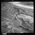 |
| A lone cyclist can be seen crossing the road bridge at Nijmegen as the Spitfire passed low overhead. |
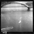 |
| The forward-facing camera captured an image of the steel truss arch of the bridge as the aircraft flashed by, with the rail bridge visible ahead. |
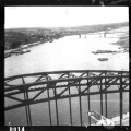 |
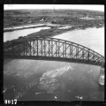
| Passing over the rail bridge, the camera also recorded merchant shipping in the south dock. |
 |
|
Grave
The third sortie of the day approached Grave from the east, flying low and fast along the course of the River Maas.
|
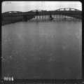 |
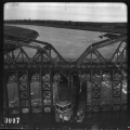
| Passing within metres of the bridge, the pilot took this image of the steel truss construction before banking north, and returning to his base in Oxfordshire. |
 |
On 17 September 1944, some 20,000 Allied airborne troops were dropped behind enemy lines, near to bridges over the rivers and canals in The Netherlands: the 101st US Airborne Division around Eindhoven, the 82nd US Airborne Division around Nijmegen and the 1st British Airborne Division around Arnhem. Simultaneously, Allied 2nd Army, with XXX Corps at its spearhead, began to advance northwards from Belgium with the objective of linking up with the airborne troops at each bridge and reaching Arnhem within four days.
German resistance to the advance of XXX Corps, and around the bridges, was stronger than anticipated. While US airborne troops had successfully captured their objectives, British airborne units had become separated and met heavy resistance in Arnhem, where they nevertheless held the north end of the road bridge.
| Airborne troops were carried to their landing zones in gliders. In this image, streams of Short Stirling and C-47 aircraft towing Horsa and Waco gliders bound for Arnhem and Nijmegen cross paths over the Dutch coast. This image was taken by a USAAF F-5 returning from a photo reconnaissance mission over the target areas. |
 |
|
At Son, the bridge over the Wilhelmina Canal had been destroyed by the Germans, to obstruct the Allied advance from Eindhoven. Once US troops had secured the area, engineers built a replacement Bailey bridge during the night of 18/19 September 1944. In this image, taken the following day, the bridge can be seen at upper-right, with a string of Allied vehicles travelling north towards Nijmegen.
|
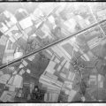 |
| US glider-borne troops landed in the fields near Son en Breugel, to secure bridges north of Endhoven. In this image from 18 September, many Waco gliders can be seen, along with a C-47 transport aircraft (ringed at upper-left) which has made an unscheduled landing, possibly forced down by German anti-aircraft fire or engine trouble. |
 |
| US Waco and British Horsa gliders litter the fields south-east of Groesbeek in this image from 18 September. US airborne troops landed here to secure the east flank of the operation against an anticipated German counter-attack from the Reichswald forest. |
 |
| Ginkel Heath, over 8 miles North-West of Arnhem, was designated as Drop Zone Y. The discarded parachute canopies of hundreds of British paratroops, dropped here on 18 September, can be seen scattered across this image. |
 |
|
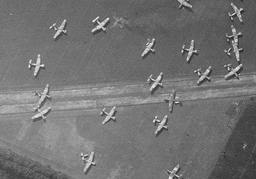
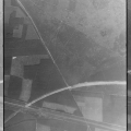
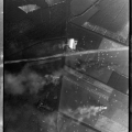
The British landing zone at Wolfheze, west of Arnhem, is shown in this image from 19 September 1944, littered with gliders which had landed there the previous day. These brought much needed reinforcements and supplies but holding this area against German counter-attacks required large numbers of troops who were needed at the bridge.
This area was also designated for the dropping by parachute of supplies of food and ammunition, and smoke can be seen billowing from markers lit to guide Allied transport aircraft to this location.
|
 |
In the face of tenacious German resistance, XXX Corps were unable to keep to the ambitious timetable set for them. On 21 September, the Germans recaptured the north end of the Arnhem bridge, while at Oosterbeek, west of the town, British and Polish troops held onto a pocket of ground until 24 September, when survivors were evacuated south, across the Rhine.


