

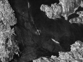
Boundary Disputes

NCAP's holdings of aerial photography span 80 years, which makes them a vital tool in litigation. Our aerial photographs can provide the detail needed to prove property boundaries and rights of way.
Many locations across the UK are covered by NCAP aerial photography at multiple dates from the 1940's to the present day. These photographs can potentially demonstrate access and boundary conditions on precise dates. Aerial photographs can provide evidence of the construction or demolition of buildings and extensions. They can depict the locations of features and additional details not present in traditional maps, providing evidence for legal professionals and home-owners. Our Letter of Authenticity can support this by documenting the provenance of an image, and assist in proving a case.
Related Links
The Guardian Online - Aerial photographs prove property boundary - 16 October 2005
NCAP Feature - Layers of cover
RICS Consumer Guide - Boundary Disputes

About our image sales
Did you know that you can purchase digital images online?
Simply locate your image and click "buy". Images ordered for personal-use can be accessed immediately after payment.
Letter of Authenticity
Prove the date a photograph was taken with a Letter of Authenticity.
Add this to your image order and our aerial photographic experts will gather key information to provide you with factual and unbiased evidence about your image. This can include:
- the precise date and time a photograph was captured
- the altitude of the aircraft
- the focal length of the camera lens
- the unit or company which took the photograph
- the method and resolution of digitisation