You are here

The D-Day Landings

Operation OVERLORD, the Allied invasion of occupied Europe, was the turning point of the Second World War. This feature highlights just a few of the events and locations in Normandy affected by the invasion on 6 June 1944. 


Operation OVERLORD began with overnight parachute and glider landings. In the early hours of 6 June 1944, large numbers of British and US airborne troops captured vital bridges and crossroads to secure the flanks of the invasion.


Pegasus Bridge saw the first engagement of D-Day. The image on the right shows three British gliders used during the assault on the bridge over the Caen canal, where they came to rest, just metres from the bridge.

Pegasus bridge
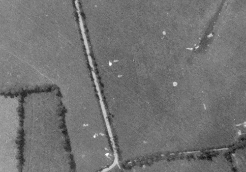
US paratroops and glider-borne troops were scattered across the western flank of the invasion. In this image, discarded parachute canopies can be seen in fields to the west of the village of Sainte-Mere-Eglise. The assault was not without cost, however, evidenced by the ground scar of a crashed C-47 transport aircraft, visible in the upper-right corner. Parachute canopies
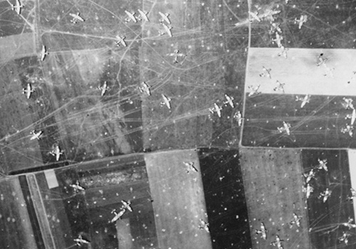
Other elements of OVERLORD included massive air attacks, naval bombardments, an early morning amphibious landing and, during the evening, the delivery of the remaining elements of the airborne divisions. This image shows British Horsa and Hamilcar gliders in fields near Ranville. Gliders


The Allies


The "D-Day" forces deployed from bases along the south coast of England, the most important of these being Portsmouth.


Allied land forces that saw combat in Normandy on June 6 came from Canada, Free France, the United Kingdom, and the United States. In the weeks following the invasion, Polish forces participated and there were also contingents from Belgium, Czechoslovakia, Greece, and the Netherlands. Most of these countries also provided air and naval support, as did the Royal Australian Air Force, Royal New Zealand Air Force and the Royal Norwegian Navy.


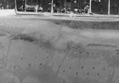
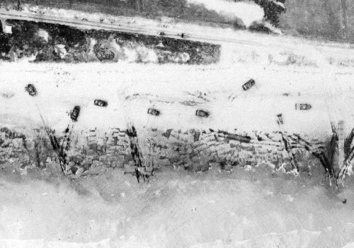
The vast and complex job of planning for the D-Day landings depended heavily on aerial photography. Years before the final choice of beaches was made, photo interpreters had been watching the entire coastline of northern France. Rows of obstacles, placed along the beaches by the occupiers, to impede an amphibious landing, were located and identified from aerial images such as this one. Beach defences
A vast armada of ships was gathered for the invasion, to carry thousands of troops and equipment across the English Channel to Normandy on 6 June 1944. In this image of SWORD Beach, on the eastern flank of the invasion, waves of landing craft can be seen on or approaching the beach, disgorging troops and armoured vehicles. Sword beach
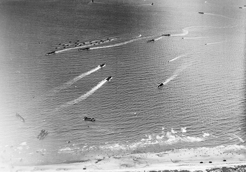
Landing craft of various sizes can be seen heading towards the beach in this image. Empty vessels from an earlier wave are heading back out to sea. Further out, large warships can be seen, providing gunfire support to troops ashore. This is JUNO Beach, where Canadian troops landed on D-Day. Juno beach
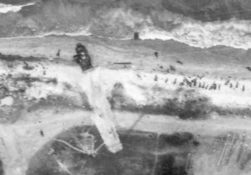
OMAHA Beach saw some of the heaviest fighting of D-Day. US troops landing here faced a sea wall and shingle bank overlooked by high ground and defensive strongpoints. With little armoured support, troops became pinned down on the beach until engineers were able to clear concrete obstacles. In this image, troops wait for an armoured bulldozer to finish clearing a path through shingle and wire entanglements. Omaha beach
Sherman tanks, mine-clearing tanks and an armoured bulldozer can be seen in this image of GOLD Beach. At upper right, plumes of smoke rise from vegetation set alight during the fighting. Gold beach
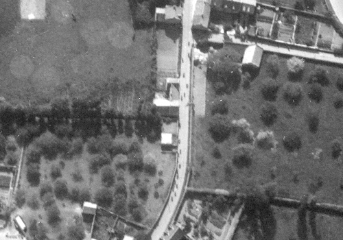
Inland from JUNO Beach, the village of Graye-sur-Mer was captured by Canadian troops. In this image, troops can be seen advancing carefully along the main street, heading south-east. Troops
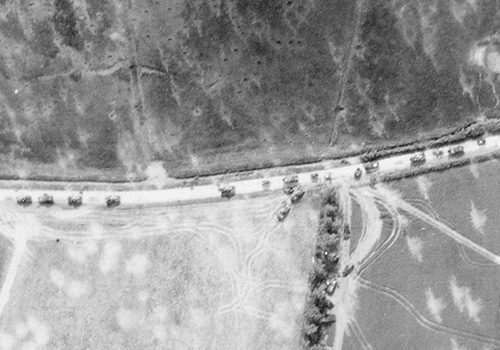
As the leading elements of the Allied forces forged inland during the afternoon of D-Day, traffic jams formed as more and more vehicles and supplies were unloaded onto the beaches. In this image, a column of armoured and engineer vehicles can be seen heading south from SWORD Beach. Vehicles
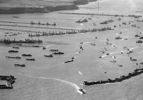
Keeping the Allied armies in Europe supplied with ammunition, food and fuel required a vast logistic chain. This image shows Mulberry 'B', an artificial harbour built immediately after D-Day to allow the Allies to bring supplies and equipment ashore from large ships. Mulberry B


Click on the links below to see more images and information on different aspects of D-Day.