New project to make 150,000 aerial images accessible
Since its launch in November 2009, over 70,000 images have been added to the NCAP website. To continue the development of our leading online resource, an 18-month dedicated digitisation project, began in January 2012 digitising, cataloguing, and uploading a further 90,000 digital images. By mid-2013, the total resource available online will be 150,000 images.
With a website subscription, users can login and zoom into all of these images at home.
The digital copies of archive aerial imagery will:
- Enable people around the world to access archive aerial images without having to visit the search room
- Preserve rare and fragile images at the same time as improving access - the production of digital copies reduces the need for physical handling of vulnerable original images
- Build a critical mass of digital content to support research in a variety of fields
- Engage with new audiences by making NCAP imagery available online for use by different communities and new technologies
Our digitisation programme for 2012-2013 will feature:
Worldwide
- Survey-quality imagery of Austria and Southern Germany from the 1950’s
- Coverage of several major European cities
- Parts of Thailand and North Africa
- Military structures such as airfields and concentration camps
Scotland
- Second World War RAF photography: a further 4000 images of Scottish locations
- More sorties from the RAF National Air Photograph Survey, covering all of Scotland in the late 1940's
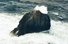
- Maritime reconnaissance photography of Rockall and the Flannan Isles
26 April 2012


