Skip to main content
Log in
|
Sign up
Home
Browse
About NCAP
Galleries
News
Features
Products & Services
Applications
Enquiries & Support
Images
Map
Finding Aids
Air Units
Mosaics
Countries
Our Work
Our Collections
Meet the NCAP Team
Subscriptions
Image Sales
Paid Image Search
Search Room
Photogrammetric Imaging
Explosive Ordnance Disposal (EOD)
Creative Uses
Boundary Disputes
Land-use Change
Police Investigation
Guides
How to use the website
Technical Terms
FAQs
Resources
Contact Us
10 images found
Active selections:
Coordinates: -0.941815,49.383812,-0.931815,49.393812
[clear]
Refine your results
KML
Loading...
Date range (both required)
Camera position
Keywords
From
Date
E.g., 27 Jul 2024
clear
To
Date
E.g., 27 Jul 2024
clear
- Select -
Vertical
Oblique
Ground
Englesqueville; Lower Norma...
Add favourite
Buy
16/0400
3066
Percée Raz de la; Lower Nor...
Add favourite
Buy
16/0400
4018
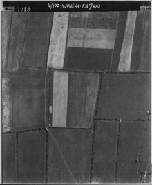
Englesqueville; Lower Norma...
Add favourite
Buy
16/0400
4019
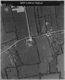
Englesqueville; Lower Norma...
Add favourite
Buy
16/0400
4020
Englesqueville; Lower Norma...
Add favourite
Buy
4/0166
4009
Englesqueville; Lower Norma...
Add favourite
Buy
4/0166
4010
Englesqueville; Lower Norma...
Add favourite
Buy
US30/4045
2127
Percée, Pointe de la; Lower...
Add favourite
Buy
9AF/0017
P_0156
Percée, Pointe de la; Lower...
Add favourite
Buy
US30/6188
7117
Le Haut Chemin; Lower Norma...
Add favourite
Buy
106G/1138
4016